GeoFanDrain® BC R7035
GeoFanDrain® BC (plastic blind drain, also known as a French drain, rubble drain, blind ditch, or under drain), is a subsurface drainage system composed of a thermoplastic resin core and filtering cloth.
Tel: +86-411-39569550 | E-mail: info@geofantex.com/geofantex@gmail.com
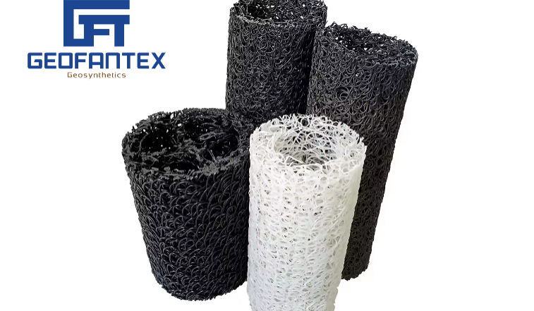
GeoFanDrain® BC (plastic blind drain, also known as a French drain, rubble drain, blind ditch, or under drain), is a subsurface drainage system composed of a thermoplastic resin core and filtering cloth.
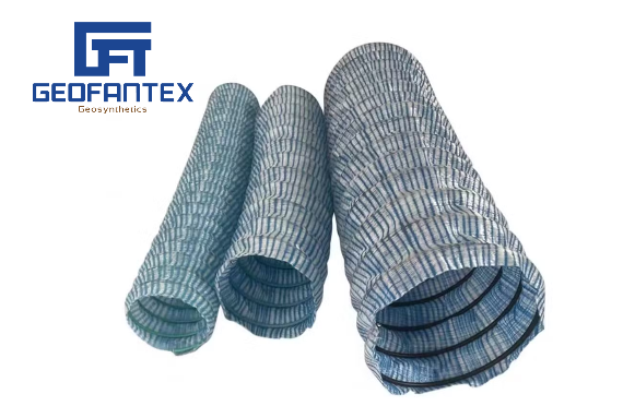
Explore how GeoFanPipe® FP is used in roadways, tunnels, slopes, and landfills to provide reliable subsurface drainage, filtration, and structural protection.
Explore how GeoFanPipe® FP is used in roadways, tunnels, slopes, and landfills to provide reliable subsurface drainage, filtration, and structural protection.
Explore how GeoFanPipe® FP is used in roadways, tunnels, slopes, and landfills to provide reliable subsurface drainage, filtration, and structural protection.
Explore how GeoFanPipe® FP is used in roadways, tunnels, slopes, and landfills to provide reliable subsurface drainage, filtration, and structural protection.
Explore how GeoFanPipe® FP is used in roadways, tunnels, slopes, and landfills to provide reliable subsurface drainage, filtration, and structural protection.
Explore how GeoFanPipe® FP is used in roadways, tunnels, slopes, and landfills to provide reliable subsurface drainage, filtration, and structural protection.
GeoFanDrain® BC (plastic blind drain, also known as a French drain, rubble drain, blind ditch, or under drain), is a subsurface drainage system composed of a thermoplastic resin core and filtering cloth.
Explore how GeoFanPipe® FP is used in roadways, tunnels, slopes, and landfills to provide reliable subsurface drainage, filtration, and structural protection.
Explore how GeoFanPipe® FP is used in roadways, tunnels, slopes, and landfills to provide reliable subsurface drainage, filtration, and structural protection.
End of content
End of content
WhatsApp us